MENU

PRODUCT · TERRITORIAL INFORMATION

Functional prototype under development and validation.

Rüpü

Territorial information for exploring protected areas with more context.

Rüpü brings maps, points, protocols and territorial information into a mobile experience designed for limited-connectivity settings. Its first version is being validated in La Campana National Park.

A product by Estudio Albatros

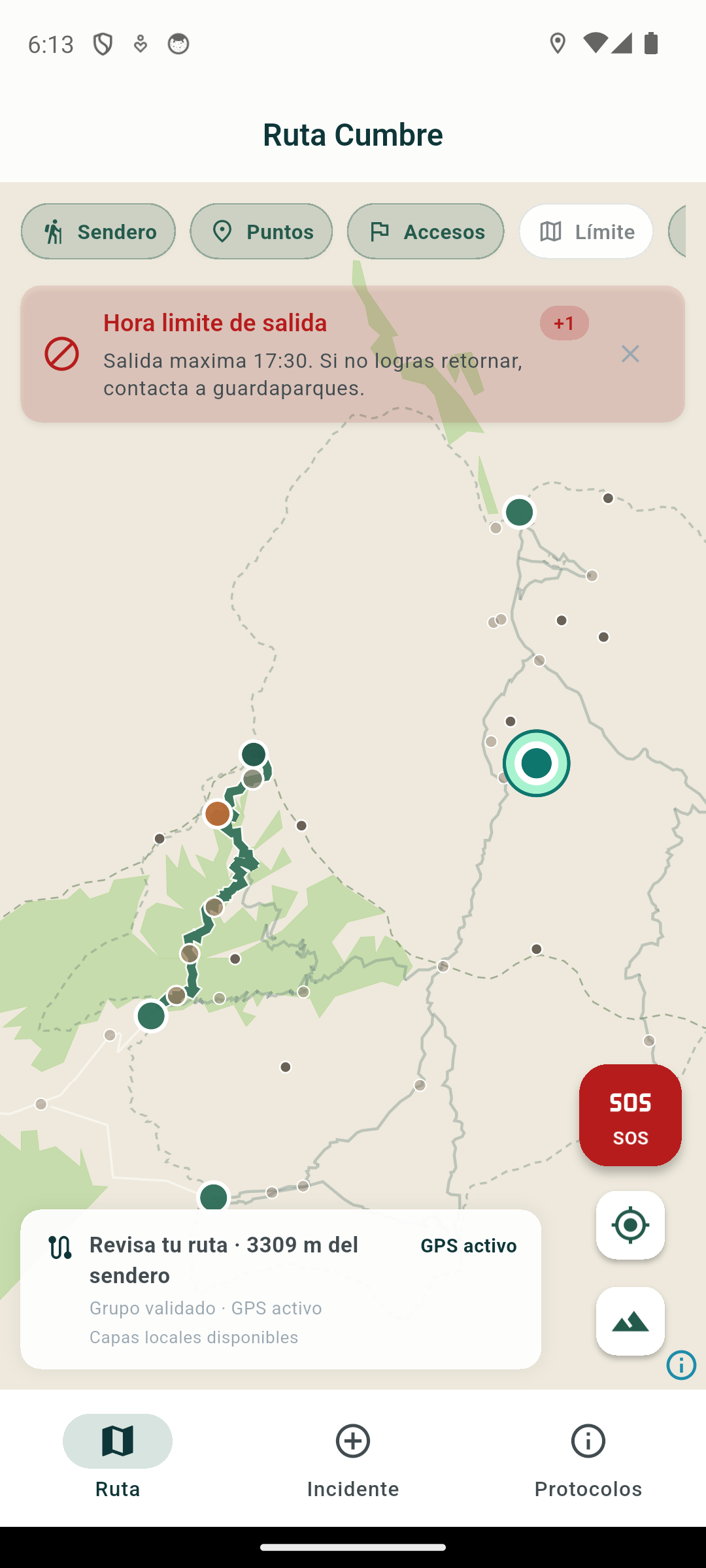
Rüpü map showing the Summit Route, territorial layers, points of interest and GPS status.

Rüpü prototype view showing the Summit Route, territorial layers and available location.

Mapping based on OpenStreetMap data. © OpenStreetMap contributors.
Reference implementation
This implementation uses territorial information for La Campana National Park to demonstrate offline navigation, routes and field-support layers. Operational information was documented in 2025 and should be checked against current official sources. The reference to the park does not imply sponsorship, institutional validation or official operation by CONAF.

CONTEXT

Information needs to be available where it is used.

Connectivity can be limited in protected areas, while information is often split across maps, signs, recommendations and protocols. Checking a reliable route, understanding a point or finding timely guidance may require several sources. Rüpü explores a way to bring that context together without assuming a permanent connection.
APPROACH

Maps and territorial content in one experience.

The prototype prioritizes mobile use, local access and territory-specific adaptation. It connects the map with points, conditions, schedules, risks and recommended actions. The offline-first approach remains under validation; it does not imply guaranteed availability, coverage or accuracy.

STATUS

What exists and what remains open.

Available in the prototype

  • Territorial map

    A Summit Route interface with visible trail, point, access and boundary layers.

  • Territorial information

    Territorial records linked to points on the map.

  • Local incident records

    A local flow with category, description and available location.

  • Emergency support

    A screen with location, contacts and basic instructions.

Under development or validation

  • Local access

    Behavior in limited-connectivity conditions.

  • Territory-specific content

    Accuracy, completeness and currency of territorial information.

  • Available location

    Location behavior across devices.

  • Territorial model

    Territory adaptation, protocols and test flows with visitors.

Future directions

  • Pilots in other territories, subject to defined scope, sources and permissions.
  • Additional territorial content once it has been adequately validated.

This list describes inspected interfaces. It does not establish coverage, data accuracy, currency or production operation.

FIRST PILOT TERRITORY

La Campana National Park.

La Campana provides a concrete territory for testing how the map, geospatial content and usage flows work together. The pilot is intended to validate the territorial model and offline experience. It does not limit future applications of Rüpü to this territory.

Institutional scope
The prototype uses La Campana National Park as a pilot territory to validate its mapping model and offline experience. This reference does not imply sponsorship, institutional validation or official operation by CONAF.

TERRITORIAL INFORMATION

More context than a coordinate.

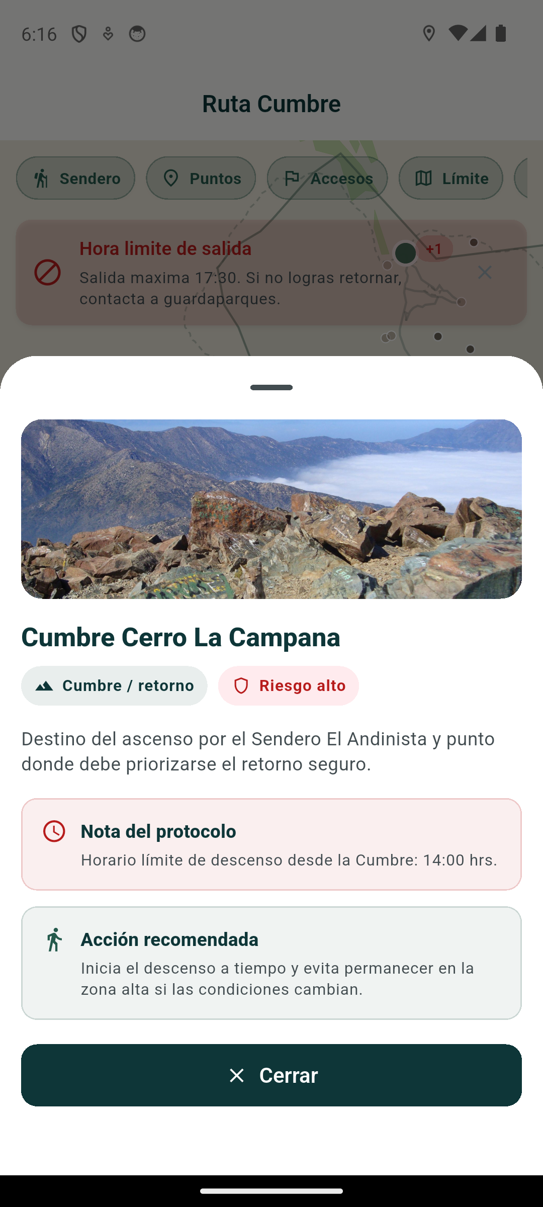
Each point can be linked to a territorial record. The first version organizes conditions, risk level, schedules, recommendations and protocols associated with a place. Each territory’s information must be checked for accuracy and currency before public use.

Record for the Cerro La Campana summit showing risk level, return time and recommended action.

Prototype territorial record for the summit of Cerro La Campana, showing risk, return time and recommended action.

Institutional scope
The prototype uses La Campana National Park as a pilot territory to validate its mapping model and offline experience. This reference does not imply sponsorship, institutional validation or official operation by CONAF.

LOCAL RECORD

A record that remains on the device.

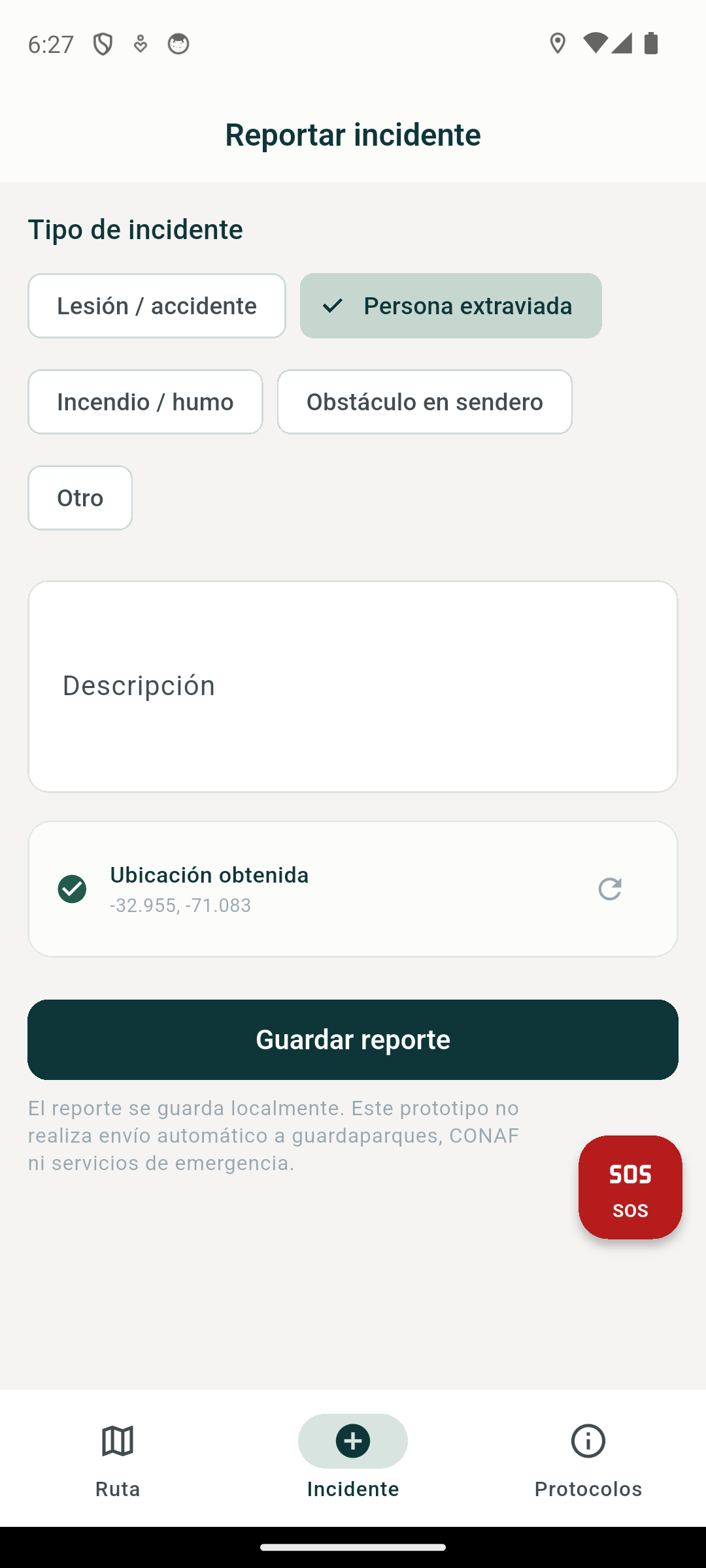
The flow allows a person to select a category, add a description and retain the available location.

Rüpü form for recording an incident and storing its location locally.

Prototype form for recording an incident and storing its category, description and location locally.

Local storage
Records are stored locally on the device. They are not transmitted automatically to administrators or emergency services.
Demonstration location
The visible location is a public coordinate used to demonstrate the prototype’s local flow.

SUPPORT

Emergency support.

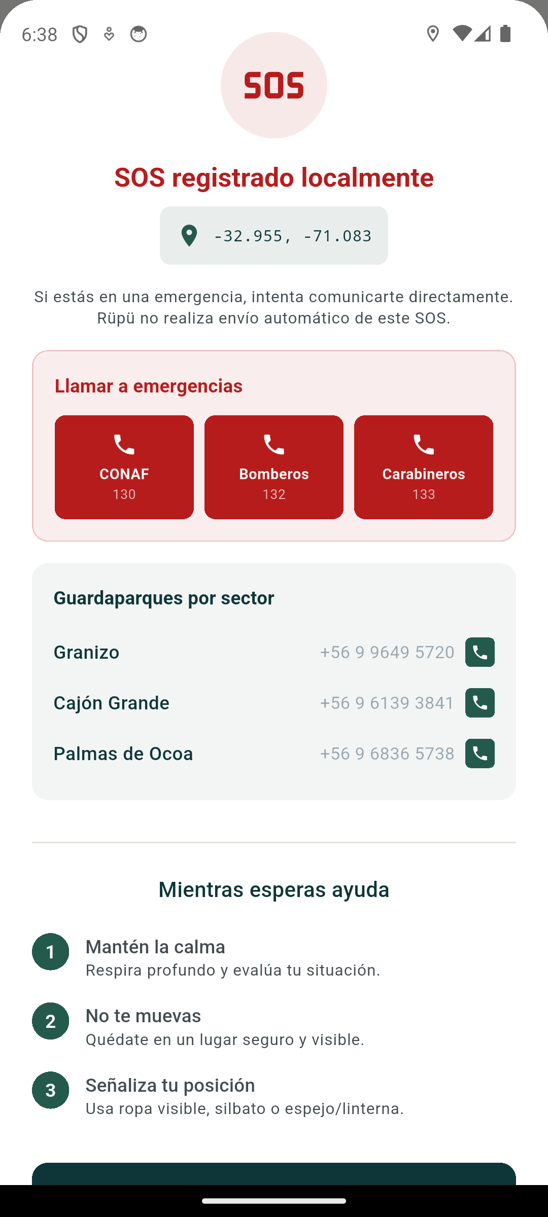
The screen brings together the available location, emergency contacts and basic instructions.

Rüpü SOS screen with a recorded location, emergency phone numbers and instructions while waiting.

The screen brings together the available location, contacts and basic instructions; it does not trigger alerts or dispatch.

Support, not dispatch
Rüpü can retain the available location locally, provide emergency contact information and display basic instructions. The prototype does not send alerts, trigger automatic dispatch or replace official emergency channels.
Contact currency
The visible contacts must be confirmed as current immediately before public use.
Institutional scope
The prototype uses La Campana National Park as a pilot territory to validate its mapping model and offline experience. This reference does not imply sponsorship, institutional validation or official operation by CONAF.

TECHNICAL FOUNDATION

A first version built for validation.

Built with Flutter and MapLibre. Territorial data is prepared and validated with PostgreSQL/PostGIS and QGIS.

ORIGIN

An initiative continuing within the Studio.

Rüpü originated within ParksTech, an initiative focused on technology for parks and protected areas. Its development now continues as a product of Estudio Albatros.


NEXT STEP

Rüpü remains under development and validation.

We are open to discussing pilots, technical collaboration and applications in other territories. Each possibility requires a review of information, permissions and scope before moving forward.

Talk to us about Rüpü